About Walt Socha

Find more about me on:

Here are my most recent posts

Author Archives: Walt Socha

June 2020 Crossover Newsletter

Update on the Crossover saga (and a request)

Collapse Update:

  • Collapse is at the editor’s for a preliminary evaluation. (Yes, this is a long process).
  • Meanwhile, I’m reviewing the characterization in Conflict (but no plot changes!).
  • And pondering the year, location, characters, and plot of Conquest, book four in the Crossover Series. And this pondering leads me to…

Request Some Help:

As discussed in a previous newsletter, it’s not too difficult to determine latitude: http://www.waltsocha.com/celestial-navigation-part-one-latitude/

Ah, but navigating East or West isn’t easy: http://www.waltsocha.com/celestial-navigation-part-two-longitude/. The problem is that back in the Middle Ages (and earlier), not only was there no GPS/satellites, there were no clocks accurate enough to maintain an accurate time on the rough seas of an ocean voyage. And that meant that there was no ability to determine longitude.

So I’m thinking: what if Haven could send radio signals? Say at high noon every day? In that case:

  • If someone at sea received that Haven-High-Noon radio signal at 3PM (not too hard to determine the passing of time locally)
  • And if they knew the latitude, say 45 degrees North.
  • Then they could calculate how far east (or west) they were relative to Haven.

Some numbers (apologies!):

  • Circumference of the earth at equator: 24,901 miles.
  • Circumference of the earth at a latitude of 45 deg North = [circumference at equator] times [cosine of 45 degrees] = 24901 miles times 0.7071 = 17,607 miles.
  • So if our intrepid travelers are sailing at 45 degrees North and they receive the Haven-High-Noon radio signal at 3PM, then they would be: 3/24 times 17,607 miles = 2,201 miles east of Haven.

So back to the question:

Is it reasonable for Haven to develop a radio system from scratch in a couple of decades?

Assumptions:

  • Access to copper.
  • Brent’s trip to the Yucatan (in Collapse) will enable Haven to access rubber (for insulation).
  • Primitive Vacuum tube diodes and triodes are possible (using Brent’s rubber for gaskets in vacuum pumps).

Your thoughts? Please send to walt@waltsocha.com

Know any Electrical Engineers or old time radio freaks? Please feel free to forward this newsletter to them!
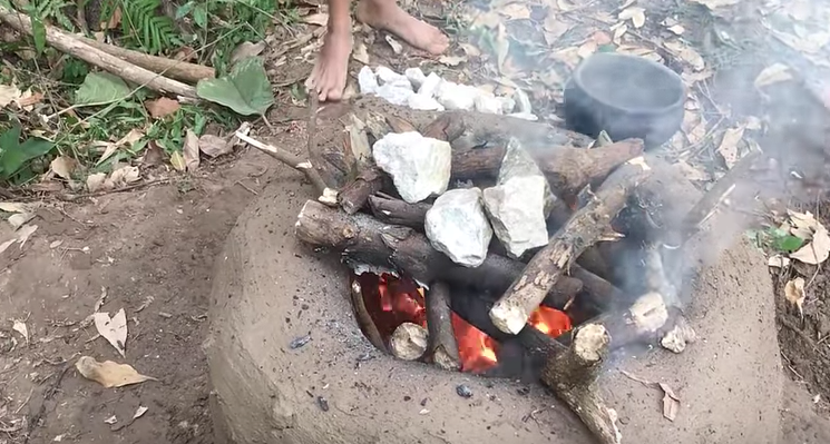
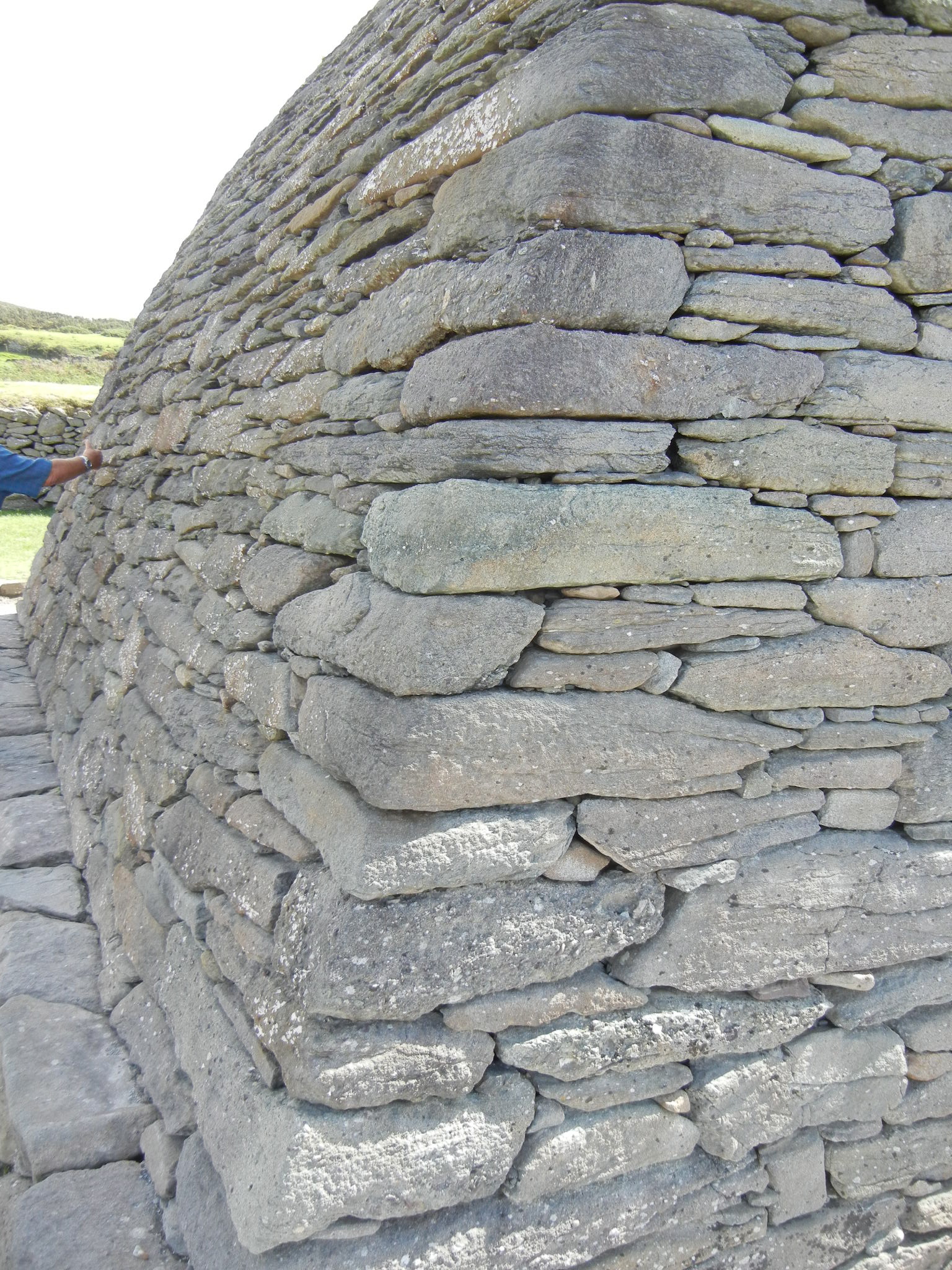
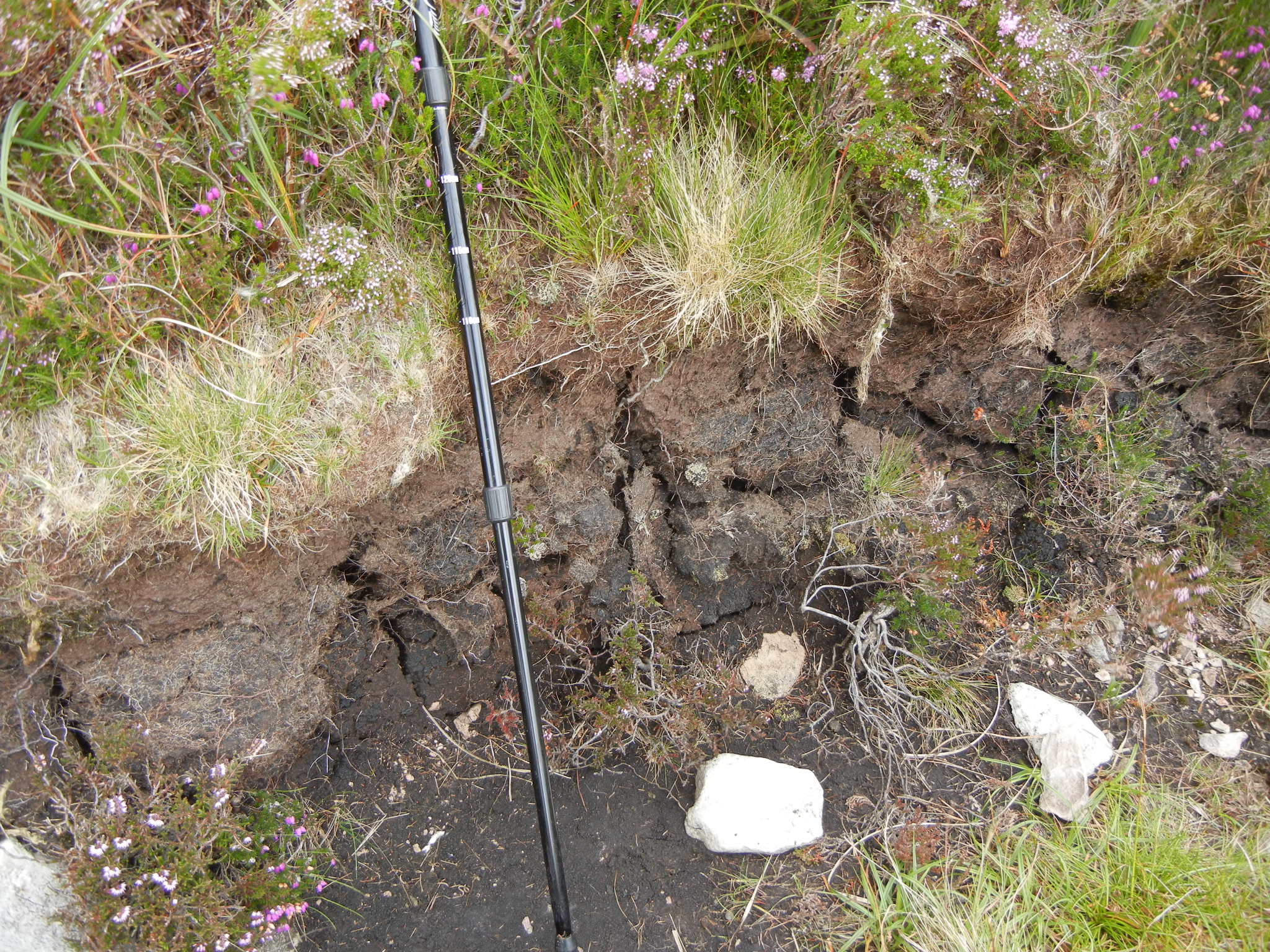
The Puzzle:

Here’s another puzzle. It’s only 48 pieces so it goes together in a jiffy when you drag the pieces around on your screen.

1. Just click HERE for the puzzle.

2. Click and drag the pieces on your device. If you leave the sound on you’ll hear a satisfying “click” when the pieces fit together.

3. Can you guess where this photo was taken? And why I considered it important when writing Collapse?

4. Email me the answer at walt@waltsocha.com

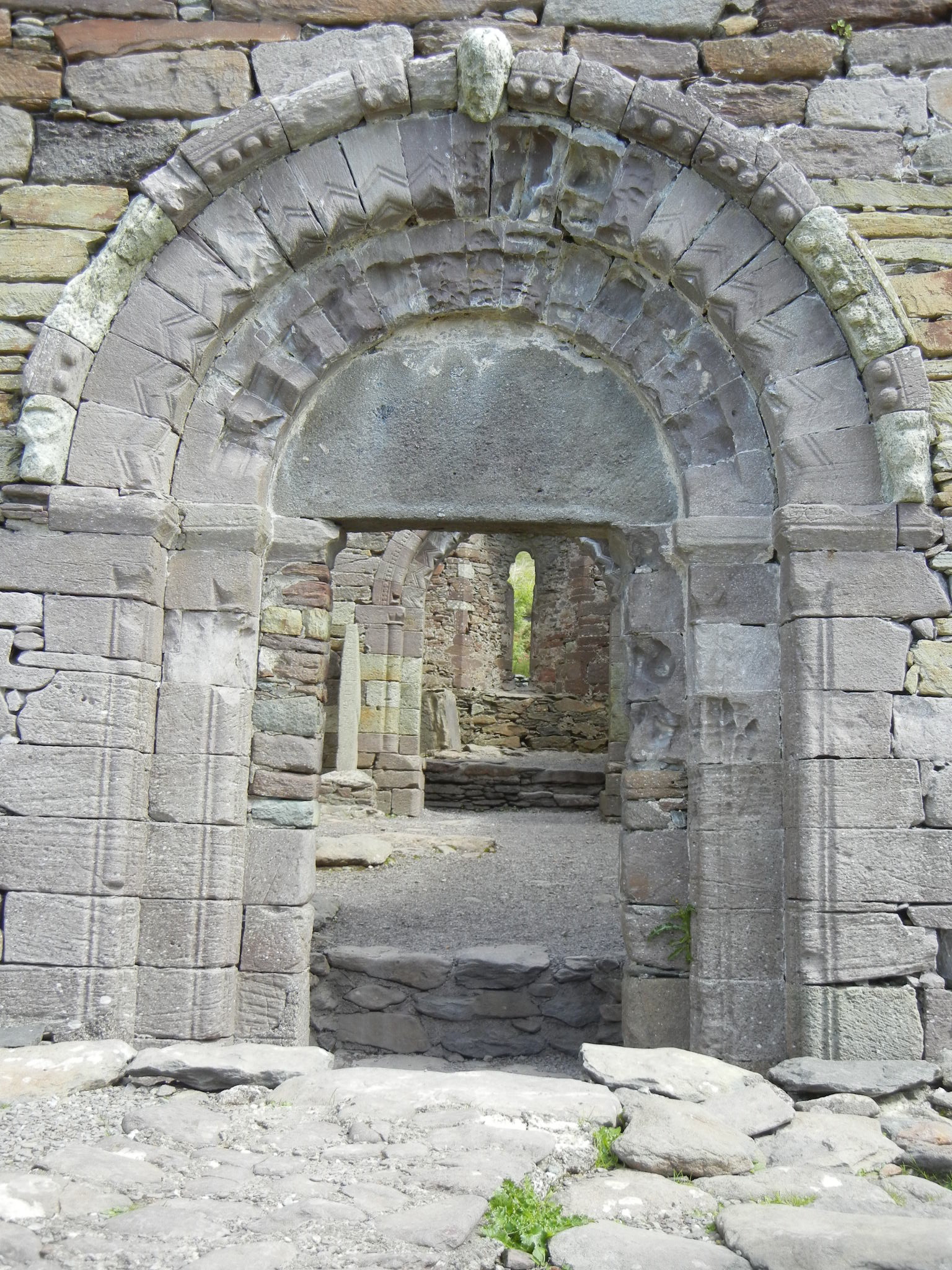
The Solution to the Previous Newsletter’s Puzzle:

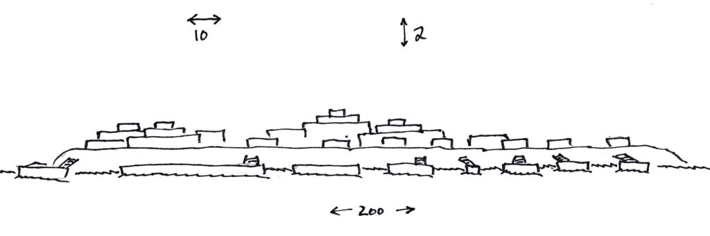
Diorama of Susquehanna hut in the State Museum of Pennsylvania

This photo was taken in the Anthropology and Archaeology Gallery at the State Museum of Pennsylvania in Harrisburg.

I chose it because it depicts the living quarters of the Susquehanna peoples back a millennium ago.

December 2019 Newsletter

  • Delays
  • Details about which an author must worry
  • A book for you to read while you’re waiting for book three
  • And a new puzzle

Collapse Update:

More delays. I won’t bore you with the details. But 2020 is still valid for release.

Picky Little Details:

Besides the external plot and the internal struggle, each novel in the Crossover Series contains a myriad of minor details.

One example is the difference between a dock and a pier.

We landlubbers may think a dock is the same as a pier, but to a professional sailer the dock is the water adjacent to the pier to which he ties his vessel. A dock is a watery parking space, while a pier is like a sidewalk.

Hence, in book three, Brent ties up the Argos to a pier. Not a dock.

Book Review:

Against the Tide of Years: A Novel of the Change by S. M. Stirling

From Amazon:

It’s spring on Nantucket Island and everything is perfectly normal, until a sudden storm blankets the entire island. When the weather clears, the island’s inhabitants find that they are no longer in the late twentieth century…but have been transported instead to the Bronze Age! Now they must learn to survive with suspicious, warlike peoples they can barely understand and deal with impending disaster, in the shape of a would-be conqueror from their own time.

From Wikipedia:

At 9:15 pm EST on March 17, 1998, the island of Nantucket, Massachusetts and the United States Coast Guard cutter Eagle, are transported by an unknown phenomenon (called “The Event”) back in time to the Bronze Age circa 1250s B.C. (corresponding to the late Heroic Age of the Trojan War).

As the truth of what has happened sinks in, panic grips the island. Chief of Police Jared Cofflin is given emergency powers and begins organizing the people to help produce food for the island so they can feed themselves. Meanwhile, Captain Marian Alston takes the Eagle to Britain, with Ian Arnstein and Doreen Rosenthal as interpreters, where they trade Nantucket made goods with the Iraiina, which translates as “Noble ones”, a tribe that has been steadily invading the island, for grain. The Iraiina are just one of the many Sun People Tribes. As a gift the Iraiina chief gives Marian a slave, Swindapa, a captured female “Earth People” warrior. Swindapa is freed and decides to stay with Marian. The Eagle leaves for Nantucket but takes with them Isketerol, a Tartessian merchant who hopes to learn from the Americans.

While the people of Nantucket work for their survival, the ambitious and ruthless Lieutenant William Walker of the USCGC Eagle, decides that with modern technology he could become a king in this time…

My take:

Not only does Mr. Stirling do a great job of taking Nantucket Island and plopping it back into the Bronze Age, he captures the life and people of that ancient time.

My complaint:

He gave his characters an entire island of technology (including machine shops and a Coast Guard sailing ship!) for their trip back to the Bronze Age. Whereas, my poor characters only had what they could take on horseback. (Joe, the Protagonist in Conflict, was quite jealous when he found out about all the tech. And no way can I repeat what Larry said…).

The Puzzle:

Here’s another puzzle. It’s only 48 pieces so it goes together in a jiffy when you drag the pieces around on your screen.

1. Just click HERE for the puzzle.

2. Click and drag the pieces on your device. If you leave the sound on you’ll hear a satisfying “click” when the pieces fit together.

3. Can you guess where this photo was taken? And why I considered it important when writing Conflict?

4. Email me the answer at walt@waltsocha.com

The Solutions to Last Newsletter’s Puzzle:

Rocks in Susquehanna River

I chose this image was chosen to illustrate the shallowness of the Susquehanna River.

Joe and his friends spent a day searching for a safe route for the horses to cross. There’s a lot of hidden crevices out there!

November 2019 Newsletter

  • Crossover Series Updates
  • Walt’s World
  • Guns, Germs and Steel Review
  • and the Puzzle

Collapse Update:

Based on discussions with a new editor, my schedule for Collapse will certainly be pushed out. Its launch will likely be in March, 2020 at the earliest. (Update: further delays expected)

Walt’s World:

Where did I get my interest in things historical?

The book 1632 by Eric Flint.

In summary: part of present-day West Virginia, complete with a whole lot of good-old union boys, finds itself plopped somewhere in Germany in 1632 – right in the middle of the 30 years war.

It’s an entertaining read. And the author, a historian by education, draws the reader into 17th century life. It certainly drew me in.

Review: Guns, Germs and Steel by Jared Diamond

One version of my elevator pitch is as follows:

The Crossover Series explores what happens when 21st century characters take knowledge of “Guns, Germs and Steel” back to 11th century, pre-contact, indigenous cultures.

So what is this book titled Guns, Germs and Steel?

From Amazon:

In this “artful, informative, and delightful” (William H. McNeill, New York Review of Books) book, Jared Diamond convincingly argues that geographical and environmental factors shaped the modern world. Societies that had had a head start in food production advanced beyond the hunter-gatherer stage, and then developed religion –as well as nasty germs and potent weapons of war –and adventured on sea and land to conquer and decimate preliterate cultures. A major advance in our understanding of human societies, Guns, Germs, and Steel chronicles the way that the modern world came to be and stunningly dismantles racially based theories of human history. Winner of the Pulitzer Prize, the Phi Beta Kappa Award in Science, the Rhone-Poulenc Prize, and the Commonwealth club of California’s Gold Medal.

My take:

Dr. Diamond’s premise can be dramatically supported by considering animal-related diseases.

In the Europe/Middle East/Northern Africa, human populations had access to multiple domesticable animals with cows, sheep, pigs being the predominant ones.

And those cultures then became exposed to disease crossing the species barrier from those animals to humans. Smallpox from cows being one well-known problem. While smallpox caused many deaths, the European/Middle East/African populations, while not becoming immune, were able to survive this disease mostly intact.

But in the Americas, there were few domesticable animals (except turkeys and llamas). And no prior exposure. And no immunity at all.

So when the Spanish landed, their animal-originated diseases spread like a shock wave through the indigenous peoples, killing off 90+% of the population, sometimes even before physical contact with the Europeans. Hence, it wasn’t European civilization that dominated the Americas – it was European diseases that did.

The Puzzle

Here’s another puzzle. It’s only 48 pieces so it goes together in a jiffy when you drag the pieces around on your screen.

1. Just click HERE for the puzzle.

2. Click and drag the pieces on your device. If you leave the sound on you’ll hear a satisfying “click” when the pieces fit together.

3. Can you guess where this photo was taken? And why I considered it important when writing Conflict?

4. Email me the answer at walt@waltsocha.com

Last Month’s Puzzle

Last month, you got to assemble a photo take from the approximate location of the lookout tower in Conflict.

I “found” this view while checking out the location back in 2012. And was thrilled when I realized that this is the exact view (except for the local gravestones and freeway cuts in the distance!) seen by Joe, Larry, and Brent.

Crossover Update: October 2019

Collapse Update

Wondering about the third book, Collapse, in the Crossover Series? Well, I’m into the editing phase. The schedule looks like:

  • Oct: self-editing
  • Nov: professional editor
  • Dec: ARC (advanced reader copies) to the Street Team (more on this next month)
  • Jan: Launch Collapse

Trade Items

Collapse takes place on a small island off the northern coast of the Yucatan Peninsula. Why do the characters from Haven want to go there?

Trade! They know that Mesoamerica has:

  • Cocoa (chocolate)…luxury trade item (okay, some would say it’s a necessary item!)
  • Cotton…practical trade item
  • Rubber…needed to further industrialize Haven and it’s areas of influence
  • Peppers…!

Mesoamerica also is a stepping stone to South America where the Havenites hope to find:

  • Quinine…necessary for interacting with Africa (hmm…foreshadowing?)
  • Silver…from the Aztec lands

Review and Homework assignment:

Order/check out the movie “Apocolypto” from your local library or online movie source and watch it.

From Amazon:

Forget any off-screen impressions you may have of Mel Gibson, and experience Apocalypto as the mad, bloody runaway train that it is.

The story is set in the pre-Columbian Maya population: one village is brutally overrun, its residents either slaughtered or abducted, by a ruling tribe that needs slaves and human sacrifices.

We focus on the capable warrior Jaguar Paw (Rudy Youngblood), although Gibson skillfully sketches a whole population of characters–many of whom don’t survive the early reels.

Most of the film is set in the dense jungle, but the middle section, in a grand Mayan city, is a dazzling triumph of design, costuming, and sheer decadent terror.

The movie itself is a triumph of brutality, as Gibson lets loose his well-established fascination with bodily mortification in a litany of assaults including impalement, evisceration, snakebite, and bee stings.

It’s a dark, disgusted vision, but Gibson doesn’t forget to apply some very canny moviemaking instincts to the violence–including the creation of a tremendous pair of villains (strikingly played by Raoul Trujillo and Rodolfo Palacias).

The film is in a Maya dialect, subtitled in English, and shot on digital video (which occasionally betrays itself in some blurry quick pans).

Amidst all the mayhem, nothing in the film is more devastating than a final wordless exchange of looks between captured villager Blunted (Jonathan Brewer) and his wife’s mother (Maria Isabel Diaz), a superb change in tone from their early relationship.

Yes, this is an obsessive, crazed movie, but Gibson knows what he’s doing. –Robert Horton

My take: it’s fairly accurate. The movie dramatizes the social pressures experienced by the Maya society due not only to overpopulation and inter-elite warfare but also to the environmental devastation caused by the making of concrete.

Puzzle

Here’s something fun to try right now…a puzzle for you made from a photo I took while exploring the location of “Conflict,” the first book in the series. It’s only 48 pieces so it goes together in a jiffy when you drag the pieces around on your screen. Here’s what you do:

  1. Just click HERE for the puzzle.
  2. Click and drag the pieces on your device. If you leave the sound on you’ll hear a satisfying “click” when the pieces fit together.
  3. Can you guess what Joe and his friend built at this spot? (Note: I was thrilled to find this open area and its view!)
  4. Email me the answer at walt@waltsocha.com

Why read Alternative History?

First: how can Alternative History be defined?

The Collins English Dictionary defines alternative history as “a genre of fiction in which the author speculates on how the course of history might have been altered if a particular historical event had had a different outcome.”

From Wikipeida:

These stories usually contain “what if” scenarios at crucial points in history and present outcomes other than those in the historical record. The stories are conjectural, but are sometimes based on fact. Alternate history has been seen as a subgenre of literary fiction, science fiction, or historical fiction; alternate history works may use tropes from any or all of these genres. 

My first exposure to Alt History was “Guns Of The South” by Harry Turtledove. From Wikipedia:

In January 1864, the Confederacy is on the verge of losing the war against the United States. Men with strange accents and oddly mottled clothing approach Robert E. Lee at the headquarters of the Army of Northern Virginia, demonstrating a rifle far superior to all other firearms of the time. The men call their organization “America Will Break” (or “AWB”). They offer to supply the Confederate army with these rifles, which they refer to as AK-47s. The weapons operate on chemical and engineering principles unknown to Confederate military engineers. The AWB establish a base in the little town of Rivington, North Carolina, making it into a combined fortress and arsenal. 

The books continues with an adverture/military thriller plot.

The second exposure was Eric Flint’s “1632”. Wikipedia:

The fictional town of Grantville, West Virginia (modeled on the real West Virginia town of Mannington) and its power plant are displaced in space-time, through a side effect of a mysterious alien civilization.[2]

A hemispherical section of land about three miles in radius measured from the town center is transported back in time and space from April 2000 to May 1631, from North America to the central Holy Roman Empire. The town is thrust into the middle of the Thirty Years’ War, in the German province of Thuringia in the Thuringer Wald, near the fictional German free city of Badenburg. This Assiti Shards effect occurs during a wedding reception, accounting for the presence of several people not native to the town, including a doctor and his daughter, a paramedic. Real Thuringian municipalities located close to Grantville are posited as Weimar, Jena, Saalfeld and the more remote Erfurt, Arnstadt, and Eisenach well to the south of Halle and Leipzig.

Grantville, led by Mike Stearns, president of the local chapter of the United Mine Workers of America (UMWA), must cope with the town’s space-time dislocation, the surrounding raging war, language barriers, and numerous social and political issues, including class conflict, witchcraft, feminism, the reformation and the counter-reformation, among many other factors. One complication is a compounding of the food shortage when the town is flooded by refugees from the war. The 1631 locals experience a culture shock when exposed to the mores of contemporary American society, including modern dress, sexual egalitarianism, and boisterous American-style politics.

Dr. Flint is a historian, so he was able to both make the middle ages interesting as well as historically accurate. (Well, except for the part where part of West Virginia plops into the Thirty Years’ War).

Warning: reading Alternative History can get one interested in real history.

So back to the question: Why read Alternative History?

My answers:

  1. Entertaining as well as informative.
  2. Makes “history” alive as opposed to just memorized (and boring) names and dates.
  3. Expands one’s knowledgable of different cultures and customs.
  4. Enables one to realize that a lot of people worked, suffered, and died to get our world to where it is now.

Okay, I can’t leave you without mentioning another Alternative History series. Jasper Fforde’s “Thursday Next” series.

  • Thursday Next is the female protagonist.
  • Setting: alternative England. Roughly now.
  • First book: “The Eyre Affair” in which Jane Eyre is kidnapped out of her book.

Okay, there’s less “alternative” than fun in this series. But it got me into writing…as I figure the author must have really had a lot of fun writing this series.

Not to worry: I’m not gonna kidnap anyone out of their book.

(Maybe…)

Questions and comments to walt@waltsocha.com

The Terrain of Isla Cerritos

Most of the action in book three, “Collapse,” (of my Crossover series) takes place on Isla Cerritos, which was a trading port connected to Chichen Itza. An artifact illustrates the importance of trade:

Artwork showing the importance of trade

An obvious question: what is/was the terrain of Isla Cerritos? And what was the appearance then as well as now?

Luckily, there have been several archaeological projects done on that island. I found the following reports to be very helpful:

  1. https://www.researchgate.net/publication/281224361_Isla_Cerritos_an_Itza_trading_port_on_the_north_coast_of_Yucatan_Mexico by  Anthony Andrews, F R Castellanos, T G Negron, & P C Rivers.
  2. https://www.researchgate.net/publication/232838123_The_Travels_of_Maya_Merchants_in_the_Ninth_and_Tenth_Centuries_AD_Investigations_at_Xuenkal_and_the_Greater_Cupul_Province_Yucatan_Mexico by Traci Ardren & Justin Lowry.

And while the island is hard to get to, a visit was photographically documented in the following article:

The island is small and only a few meters (my characters are starting to use the measurement “strides” which is about a meter) high:

View of Isla Cerritos (from the infomaya.jp article)

It is thought that the island was “mined” for the stone after it was abandoned (When? Probably when Chichen Itza fell around 1200 CE or so). So today, there’s not much remaining:

Remains of foundations on Isla Cerritos (from the infomaya.jp article)

How archaeologists view Isla Cerritos today:

Archaeological mapping of Isla Cerritos today

So we know it’s a small island, not very high. But what did it look like in the 11th century? Here’s where literary license (and a lot of reference books) come into play. Surata (Brent’s daughter!) made this drawing as they approached the island:

Vertically exaggerated view of Isla Cerritos sketched by Surata. Dimensions in meters/strides

While on the island, Brent made this rough sketch:

Brent’s sketch of Isla Cerritos in the 11th Century

Fox, Vulture, Deer, and Jaguar are the names of the elite clans/families who run this trading island.

Caveat: Brent and Surata are likely to improve their sketches.

The name “Isla Cerritos” is Spanish. I’ve tentatively called it “Turtle Island” in the book. Any suggestions as to a better name?

Interested in the Maya? Allow me to suggest: “Maya to Aztec: Ancient Mesoamerica Revealed” by Dr. Edwin Barnhart (put out by The Great Courses). A great primer! 48 lectures on 8 DVDs. (It’s probably in your local library).

Questions or comment are welcome! Send to walt@waltsocha.com


Maya Numbers

The ancient Maya developed a positional number system based on groups of 20 (“base 20”).

Positional number system? Base 20?

Let’s look at our modern number system to understand those terms:

  • Our system is sometimes considered Arabic (even though Arabia obtained this system from India). I will indicate if a number is Arabic (or base 10) for clarity.
  • Our system consists of ten symbols: 1, 2, 3, 4, 5, 6, 7, 8, 9, and the null value “0”
  • Our system is positional. Each number has a different value depending on its relative position.
  • Our system is base 10. Each positional number is a multiple of some power of ten. 

For example, take the number 126. Each digit means a different value depending on position. Starting from the right-most digit:

  • Six times one (Note: ten to the zero power is “one”).
  • Two times ten (or ten to the first power)
  • One times ten squared (or ten to the second power).

Twenty Maya Numbers

Twenty Maya Numbers

The Maya number system is base 20. It is positional. But it only uses dots, lines, and a special null symbol which are combined to make twenty symbols:

Larger numbers require extra positions which the Maya stacked vertically (in the following figure, the square are added to help differentiate a lower value from the upper for clarity – the Maya did not use these squares!):

Large Maya Numbers

Large Maya Numbers

Revisiting our number “126”: To convert 126 (Arabic) into base 20, we first need to determine how the Arabic number 126 can be divided up into groups of twenty:

  • twenty times twenty = 400: but there are no groups of 400 in 126 (Arabic)
  • twenty: there are six groups of twenty in 126 (Arabic)
  • ones: there are six groups of ones in 126 (Arabic)

126 as a Maya Number

126 as a Maya Number

So 126 in our Arabic system is equivalent to six groups of twenty and six ones. And we know that six is represented by the Maya with a bar and a dot. So we need to use a bar and a dot twice.

In our modern (Arabic) system, the positions are written horizontally, with the ones on the right and the groups of 10 to the left.

But we know that, in the Maya system, the positions are written vertically, with the ones at the bottom and the groups of 20 above the ones.

So the value of 126 (Arabic) is written in Maya as 
…where the squares are again added for separate the two symbols. The upper symbol gives the number of groups of twenty (6 x 20 = 120). The lower gives the number of ones (6 x 1 = 6). Hence, the two symbols (in the given orientation) describe our Arabic value of 126.

For additional study (and how to add, subtract, multiply, and divide), check out: http://localhs.com/pdf/english_mayan_math.pdf

What do cement and tortillas have in common?

Answer: The ancient Maya used lime for both.

From Wikipedia: https://en.wikipedia.org/wiki/Lime_(material):

  • Lime is a calcium-containing inorganic mineral in which carbonates, oxides, and hydroxides predominate. In the strict sense of the term, lime is calcium oxide or calcium hydroxide. It is also the name of the natural mineral (native lime) CaO which occurs as a product of coal seam fires and in altered limestone xenoliths in volcanic ejecta. The word lime originates with its earliest use as building mortar and has the sense of sticking or adhering.
  • These materials are still used in large quantities as building and engineering materials (including limestone products, cement, concrete, and mortar), as chemical feedstocks, and for sugar refining, among other uses. Lime industries and the use of many of the resulting products date from prehistoric times in both the Old World and the New World. Lime is used extensively for wastewater treatment with ferrous sulfate.

How do we obtain lime?  Start with limestone and add some heat:

  • Limestone is calcium carbonate which breaks down with heat.
  • Limestone + heat = Lime + carbon dioxide (or, for the chemists out there: CaCO3 + heat -> CaO + CO)
  • Note: CaO is called quicklime.

The process can be a simple as adding layers of limestone and firewood to a pit and burning it: https://www.youtube.com/watch?v=R2JCoe0GRpg

Man standing in lime pit

Here, the “kiln” pit is the size of a man

A smaller scale example: https://www.youtube.com/watch?v=r39dvtQBs44

Small fireplace used to burn limestone

Here the “kiln” is a bit smaller than in the previous example

Note that in both videos, the chunks of limestone are added to water after being heated. This is because CaO is not stable and, over time, it will revert to CaCO3.

In order to stabilize the quicklime/CaO, “slake” it with just enough water to form calcium hydroxide or slaked lime:

  • CaO + H2O -> Ca(OH)2 (note: this releases heat!)
  • Both CaO and Ca(OH)2 are in the form of a white powder (once it is crushed)
  • Note: slaking (a geological term) is the process in which earth materials disintegrate and crumble when exposed to moisture.

The lime, in the form of Ca(OH)2, can now be used to make cement, plaster/mortar, or concrete.

A demonstration: https://www.youtube.com/watch?v=JfmRKjIJmOQ where the cement was prepared in the following way:

  • Sand / Silt was collected from the river and drained of water.
  • The quicklime previously fired was crushed into half a pea-sized pieces (in this case, skipping the slaking step…but using the material immediately) and added to the sand at a ratio of 1:2 and mixed thoroughly.
  • Then water was added to allow the chemical reaction to begin and added throughout mixing as water escaped as steam.

Construction of clay wall using lime cement

Lime cement used to join clay bricks

A comprehensive explanation of lime used as plaster/mortar, cement, and concrete:https://www.youtube.com/watch?v=i97FZevqcPw&t=208s

The ancient Maya used the slaked lime to both join rocks and plaster a finished wall, in order to build their massive cities.

Thousand year old plaster and mortar

Original stonework and plaster in a protected section of a ruin (Dzibilchaltun, in northern Yucatan).

Now let’s look at cooking maize.

Plain cooked maize kernels are deficient in niacin. But cooking them with lime (in a process called “nixtamalization”) enables more of the maize’s nutrients to be available to our bodies.

From Wikipedia:

The nixtamalization process was very important in the early Mesoamerican diet, as unprocessed maize is deficient in free niacin. A population that depends on untreated maize as a staple food risks malnourishment and is more likely to develop deficiency diseases such as pellagra, niacin deficiency, or kwashiorkor, the absence of certain amino acids that maize is deficient in. Maize cooked with lime or other alkali provided niacin to Mesoamericans. Beans provided the otherwise missing amino acids required to balance maize for complete protein.

Also from Wikipedia:

The ancient process of nixtamalization was first developed in Mesoamerica, where maize was originally cultivated. There is no precise date when the technology was developed, but the earliest evidence of nixtamalization is found in Guatemala’s southern coast, with equipment dating from 1200–1500 BC.

Video about nixtamalization: https://www.youtube.com/watch?v=TIs3gjOPevw

Maize kernels before heating in limewater

Maize kernels before heating in limewater

See also: https://en.wikipedia.org/wiki/Nixtamalization

Take-a-way: The ancient Maya were both

  • accomplished engineers
  • culinary chemists!

Which should not be a surprise given that they had larger populations and larger cities than Europe before and during the Middle Ages.

And don’t forget the ancient Maya had a “zero” in their number system (more on that later).

Questions? Thoughts? Corrections? Please email me at walt@waltsocha.com

Contact: Monastery North of Ros’s Farmstead

While writing “Contact,” I had a scene in which a couple of my (not-so-nice) characters discussed the acquisition of local “assets” north of Ros’s farmstead (the location of modern-day Dingle, Ireland).

The few farmsteads to the north have been stripped of food and fodder. But even this side will soon be barren unless we obtain more thralls to work the land.

But, from a tour of Ireland, I knew there was a Monastery in the same region, hence I knew I had to add a line to that paragraph:

The few farmsteads to the north have been stripped of food and fodder. Even the small monastery is now barren. But even this side will soon be barren unless we obtain more thralls to work the land.

So what did/does this Monastery look like? Here is an encompassing view showing the surviving church:

Gallarus Oratory

Monastery North of Ros’s Farmstead

No doubt, the stone church was surrounded by less permanent structures such as residences, cattle pens, storage buildings (made of wattle and daub), and fencing.

It’s quite interesting that the church’s door and the only window line up:

Monastery

Looking East through Gallarus Oratory

The construction is also of interest. No mortar. Only gravity holds it together:

Gallarus Oratory's Stonework

Morterless Construction

An interior view showing the intersection of ceiling and walls:

Gallarus Oratory's Stonework

Interior View of Stonework

A much more elaborate religious structure stood a few miles away. But as it was built in the 1200’s, it didn’t make it into the story:

Church of Kilmalkedar,

Church near Gallarus Oratory

Collapse: status

I’ve got a rough outline of the main plot. But as I write (I’m only at 9000 words…90,000 is typical book length), all sorts of sub-plots are slipping in.

This is a complicated story. Especially since the Maya civilization is so alien to us/me.

Also,  they had larger cities than Europe in the middles ages. And larger populations. And they are one of the few civilizations that developed (on their own) the concept of “zero” in their number system.

Need a read while waiting for Collapse? May I suggest:

“1632” by Eric Flint

From Amazon:

In Flint’s novel of time travel and alternate history, a six-mile square of West Virginia is tossed back in time and space to Germany in 1632, at the height of the barbaric and devastating Thirty Years’ War.

Oh, and the eBook version is free on Amazon.

“Island In The Sea Of Time” by S. M. Stirling

From Amazon:

It’s spring on Nantucket and everything is perfectly normal, until a sudden storm blankets the entire island. When the weather clears, the island’s inhabitants find that they are no longer in the late twentieth century…but have been transported instead to the Bronze Age! Now they must learn to survive with suspicious, warlike peoples they can barely understand and deal with impending disaster, in the shape of a would-be conqueror from their own time.

Finally, my all time favorite (and rather weird) series:

“The Eyre Affair: A Thursday Next Novel” by Jasper Fforde (not a typo!)

From Amazon:

Fans of Douglas Adams and P. G. Wodehouse will love visiting Jasper Fforde’s Great Britain, circa 1985, when time travel is routine, cloning is a reality (dodos are the resurrected pet of choice), and literature is taken very, very seriously: it’s a bibliophile’s dream. England is a virtual police state where an aunt can get lost (literally) in a Wordsworth poem and forging Byronic verse is a punishable offense. All this is business as usual for Thursday Next, renowned Special Operative in literary detection. But when someone begins kidnapping characters from works of literature and plucks Jane Eyre from the pages of Brontë’s novel, Thursday is faced with the challenge of her career. Fforde’s ingenious fantasy—enhanced by a Web site that re-creates the world of the novel—unites intrigue with English literature in a delightfully witty mix. Thursday’s zany investigations continue with six more bestselling Thursday Next novels, including One of Our Thursdays is Missing and the upcoming The Woman Who Died A Lot.

Hey, any story in which Jane Eyre is kidnapped from her book has gotta be great…

For questions, comments, and general BS, please drop me a line at walt@waltsocha.com

PS…link to information on the Monastery: http://www.gallarusoratory.ie/


Hike through the Caragh Valley

The major location in the second book, Contact, of my Crossover series, takes place in the Caragh Valley in southern Ireland.

I had spent a couple of years peering down from Google’s satellites onto southern Ireland, with a lot of that time making sure I got the geographical details correct.

Caragh Valley

Google Earth view of Caragh Valley relative to Dingle

But a bird’s eye view is not the same as boots on the ground (if you will allow me to mix my cliches..).

In 2015, my wife and I had the privilege of touring Ireland. And spent several nights in Dingle (otherwise know as “Ros’s farmstead” in Contact).

With a free day from the tour, I took a (rather expensive) taxi to the Caragh Valley. Luckily, I took photos as we drove. And one photo was of the side of a rocky hill that eventually became “Bald Hill” (a lookout and then a defensive position in the book):

Bald Hill

Terrain Around Bald Hill

Once there, I hiked 10 miles from the location of Sanctuary up the mountain to “Windy Pass”, and then north along the Caragh Lake to a point where I could see where it drains into the lower Caragh River.

Caragh Valley Route

Map of Hike Through Caragh Valley

Back in the 11th century, oak forests dominated the landscape. But in the 18th, the British effectively clear-cut the island’s oaks to build their navy. So some imagination was required to ‘reforest’ the landscape.

Here’s the location of “Sanctuary,” as seen from across the upper Caragh Rive. Sanctuary is to far right (view from Bed & Breakfast on opposite shore):

Location of Sanctuary

Terrain around Sanctuary

The hike climbed the west mountainside, which affords great views. Here’s looking south:

View of Caragh Valley looking south

View to south with location of Sanctuary

I detoured up the mountain to “Windy Pass,” named for the strong winds that cut through the dip in the mountains. Here’s a view toward “Ros’s farmstead” (present-day Dingle), which lies across the bay:

Windy Pass

View looking west from Windy Pass

While on what-the-Irish-call mountains, I found peat! I had thought it was formed only in low depressions…but apparently, it just needs to be constantly wet. (And, yes, I did get a bit wet on this hike…but, hey, I’m from Oregon…so no problem).

Peat near Windy Pass

Peat near the top of the mountains that form the west side of Caragh Valley

Here’s a view looking north that shows the lower Caragh Lake as well as the small island and protrusion of land that pinches the lake into two parts:

Lower Caragh Lake

Lower Caragh Lake

As I hiked out of the valley, I could see the lower Caragh River (Hey, sorry about all the uppers and lowers when referring to the Caragh River and Caragh Lake!). A bit rocky. No wonder Larry and his crew had to drag the Seabird upriver along several stretches.

Lower Caragh River

Lower Caragh River

Finally, after a long day, I reached the pickup point for the Taxi back to Dingle:

End of hike!

End of hike!

And, yes, Guinness is way better in Ireland…

best regards,
Walt

P.S. If you enjoy my books, please consider posting an honest review on the site from which you bought it. Reviews really help authors sell more books and readers discover new stories. Thank you!

PPS…and if you haven’t read one yet, remember that the eBook version of the first, Conflict, is free at Amazon, Kobo, and Nook.