The major location in the second book, Contact, of my Crossover series, takes place in the Caragh Valley in southern Ireland.
I had spent a couple of years peering down from Google’s satellites onto southern Ireland, with a lot of that time making sure I got the geographical details correct.
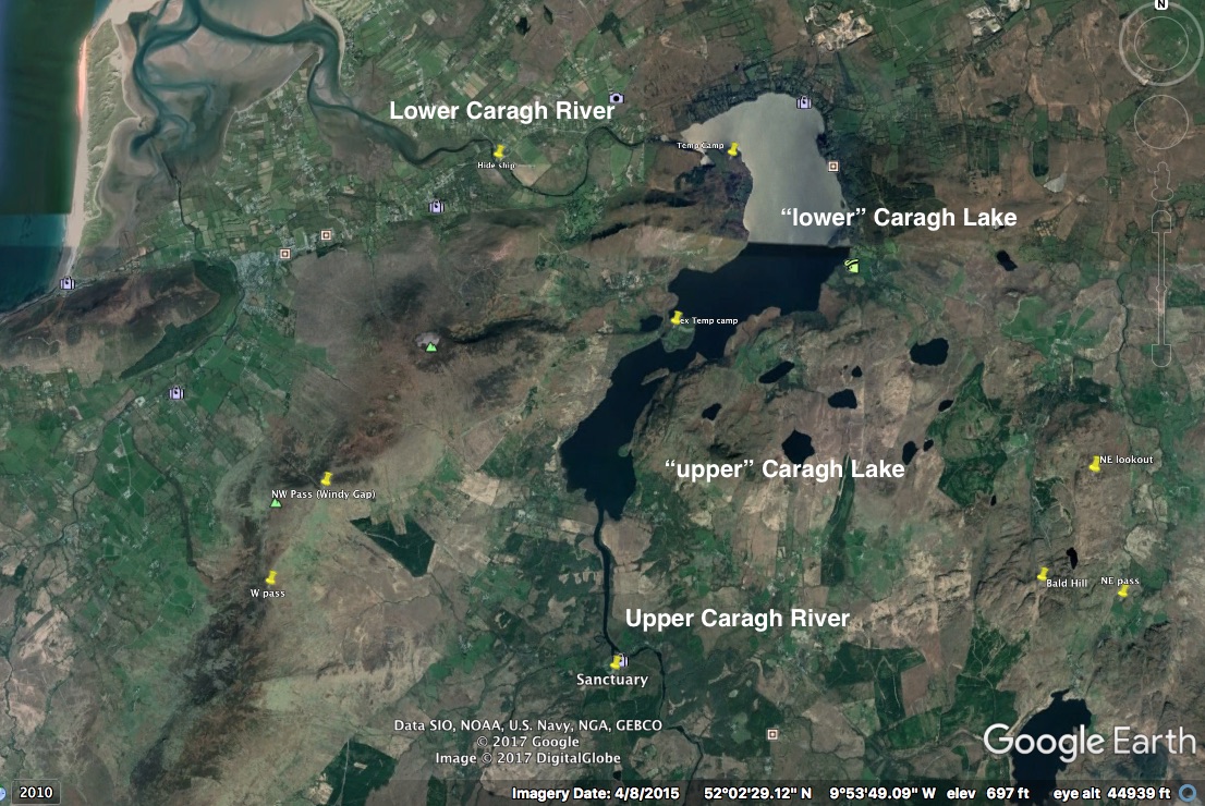
Google Earth view of Caragh Valley relative to Dingle
But a bird’s eye view is not the same as boots on the ground (if you will allow me to mix my cliches..).
In 2015, my wife and I had the privilege of touring Ireland. And spent several nights in Dingle (otherwise know as “Ros’s farmstead” in Contact).
With a free day from the tour, I took a (rather expensive) taxi to the Caragh Valley. Luckily, I took photos as we drove. And one photo was of the side of a rocky hill that eventually became “Bald Hill” (a lookout and then a defensive position in the book):
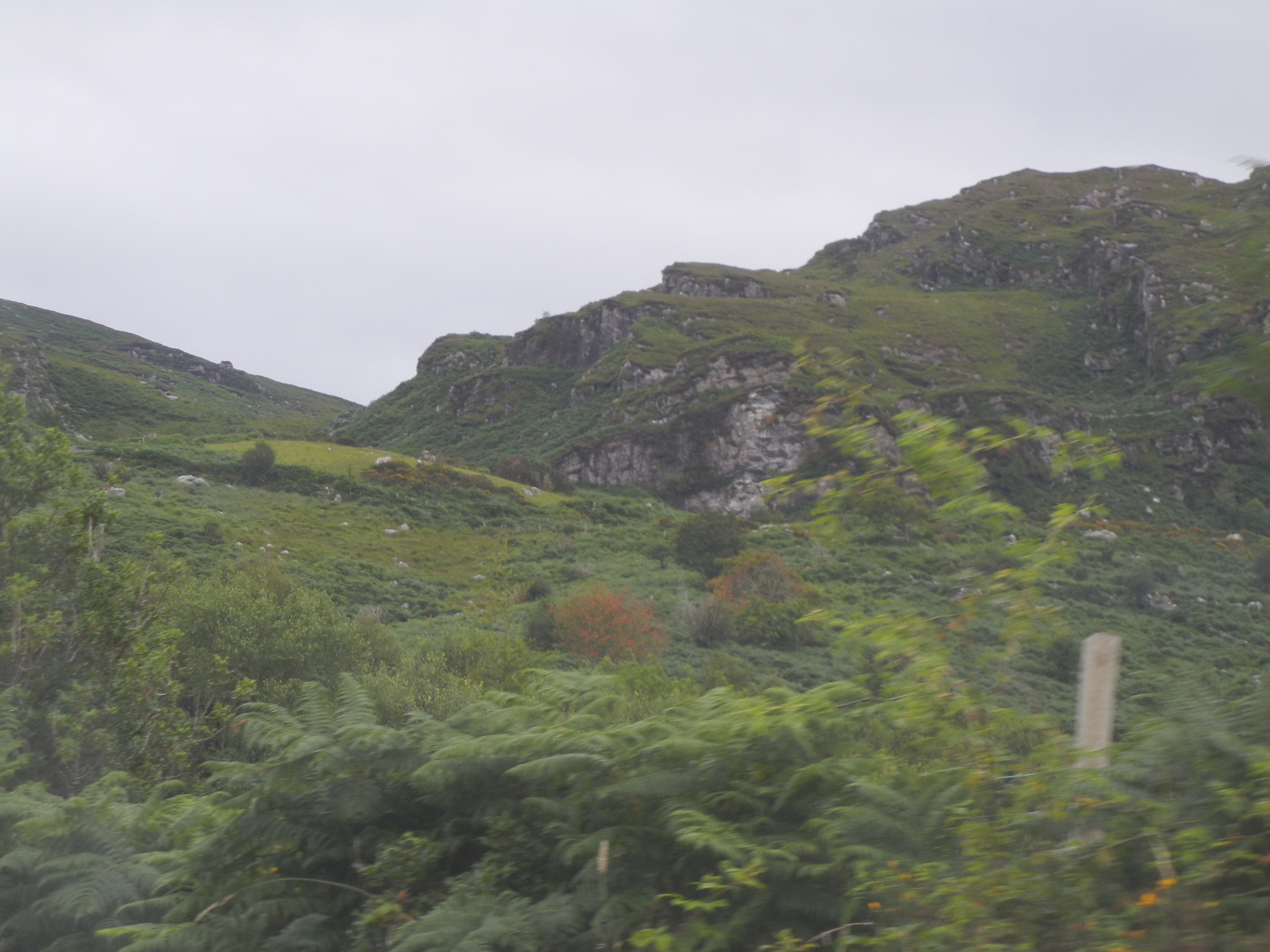
Terrain Around Bald Hill
Once there, I hiked 10 miles from the location of Sanctuary up the mountain to “Windy Pass”, and then north along the Caragh Lake to a point where I could see where it drains into the lower Caragh River.
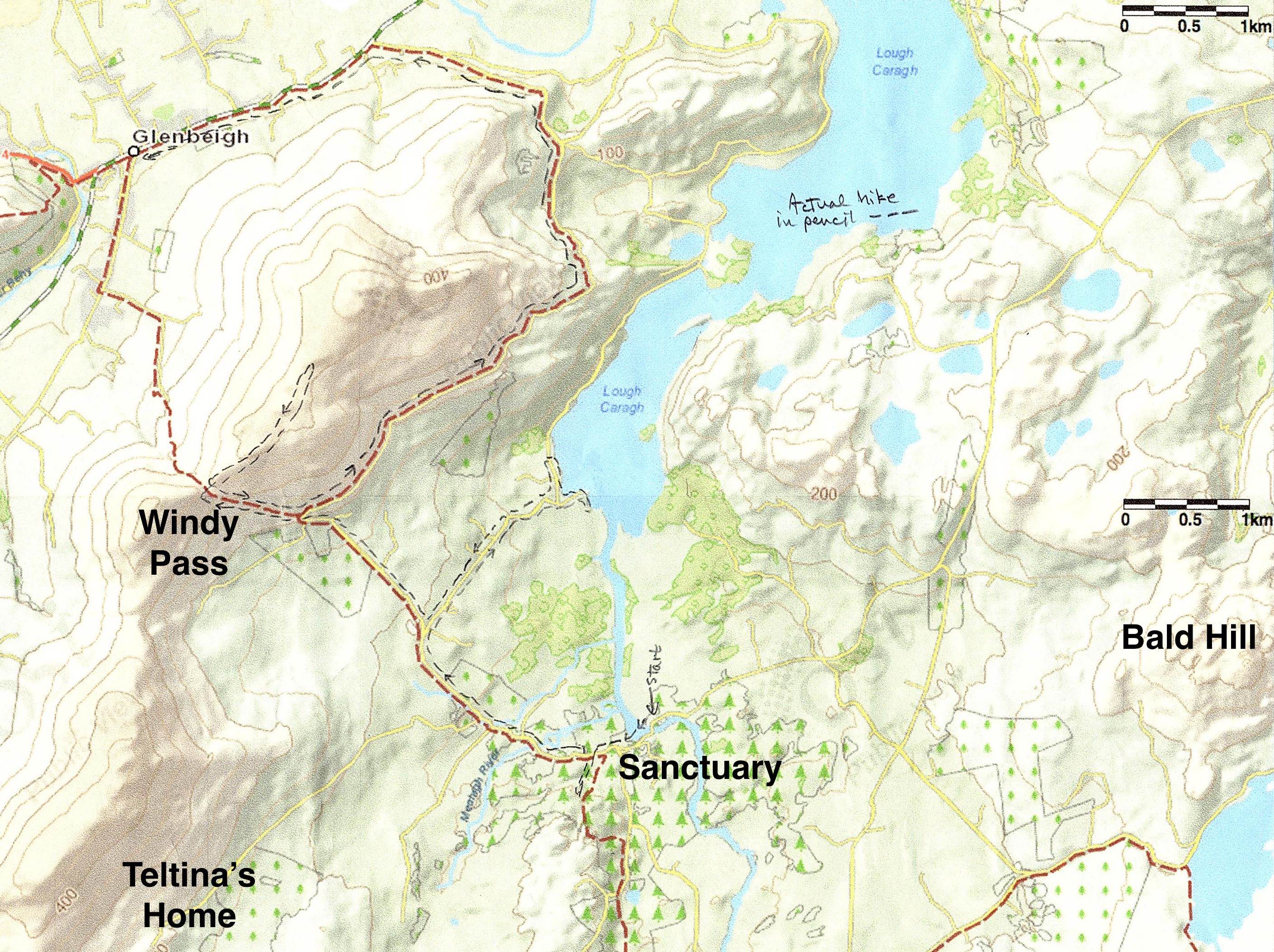
Map of Hike Through Caragh Valley
Back in the 11th century, oak forests dominated the landscape. But in the 18th, the British effectively clear-cut the island’s oaks to build their navy. So some imagination was required to ‘reforest’ the landscape.
Here’s the location of “Sanctuary,” as seen from across the upper Caragh Rive. Sanctuary is to far right (view from Bed & Breakfast on opposite shore):
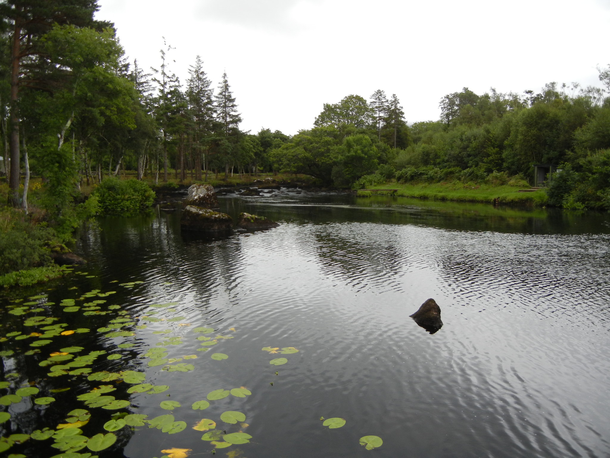
Terrain around Sanctuary
The hike climbed the west mountainside, which affords great views. Here’s looking south:
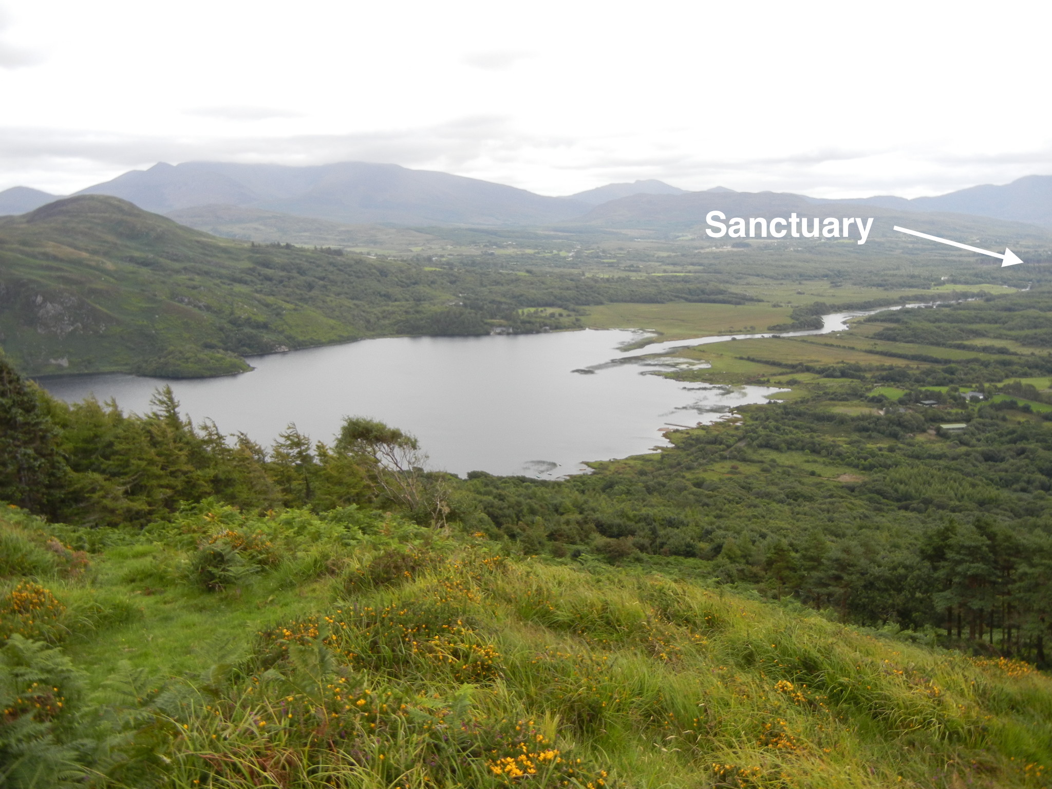
View to south with location of Sanctuary
I detoured up the mountain to “Windy Pass,” named for the strong winds that cut through the dip in the mountains. Here’s a view toward “Ros’s farmstead” (present-day Dingle), which lies across the bay:
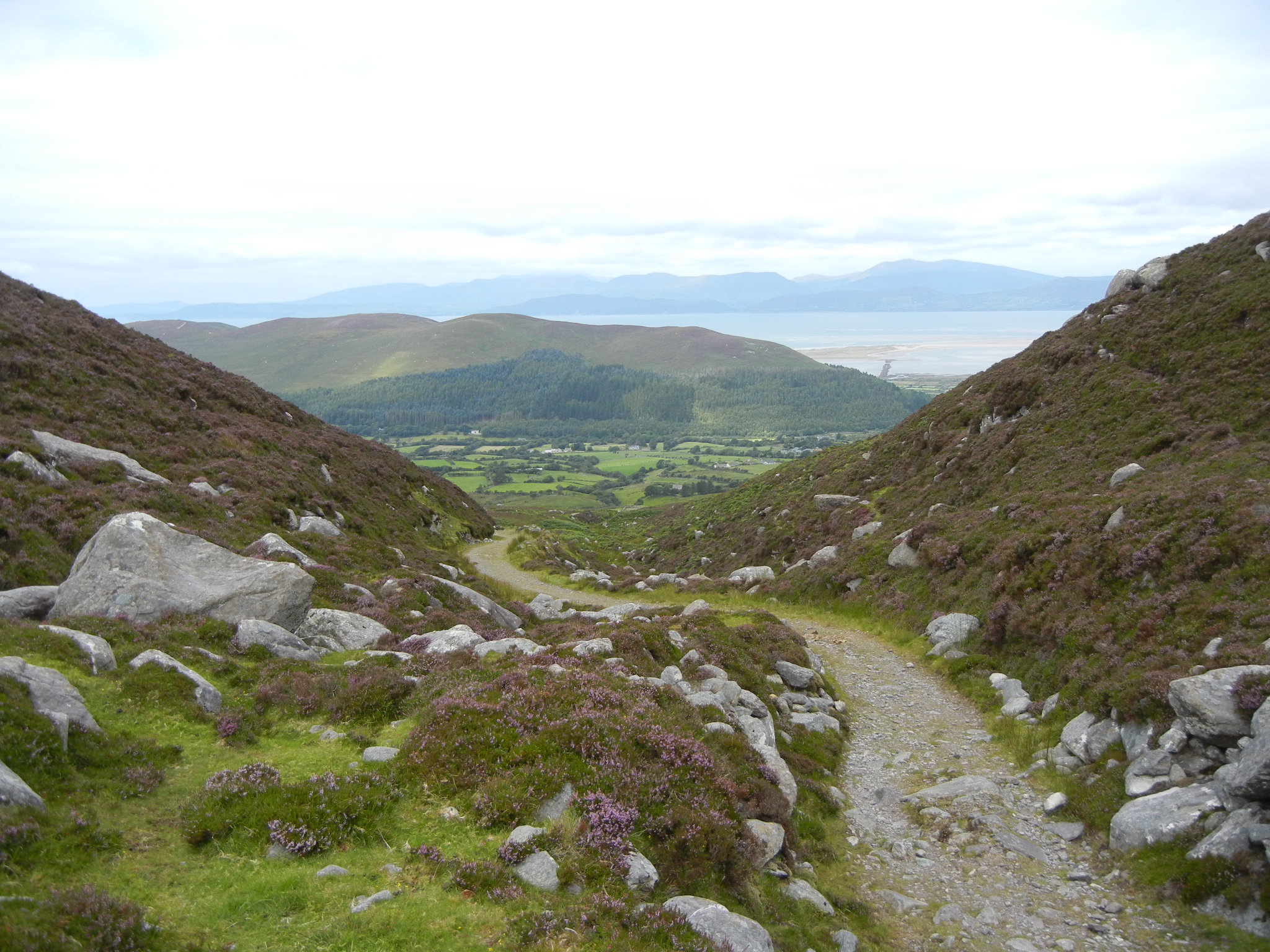
View looking west from Windy Pass
While on what-the-Irish-call mountains, I found peat! I had thought it was formed only in low depressions…but apparently, it just needs to be constantly wet. (And, yes, I did get a bit wet on this hike…but, hey, I’m from Oregon…so no problem).
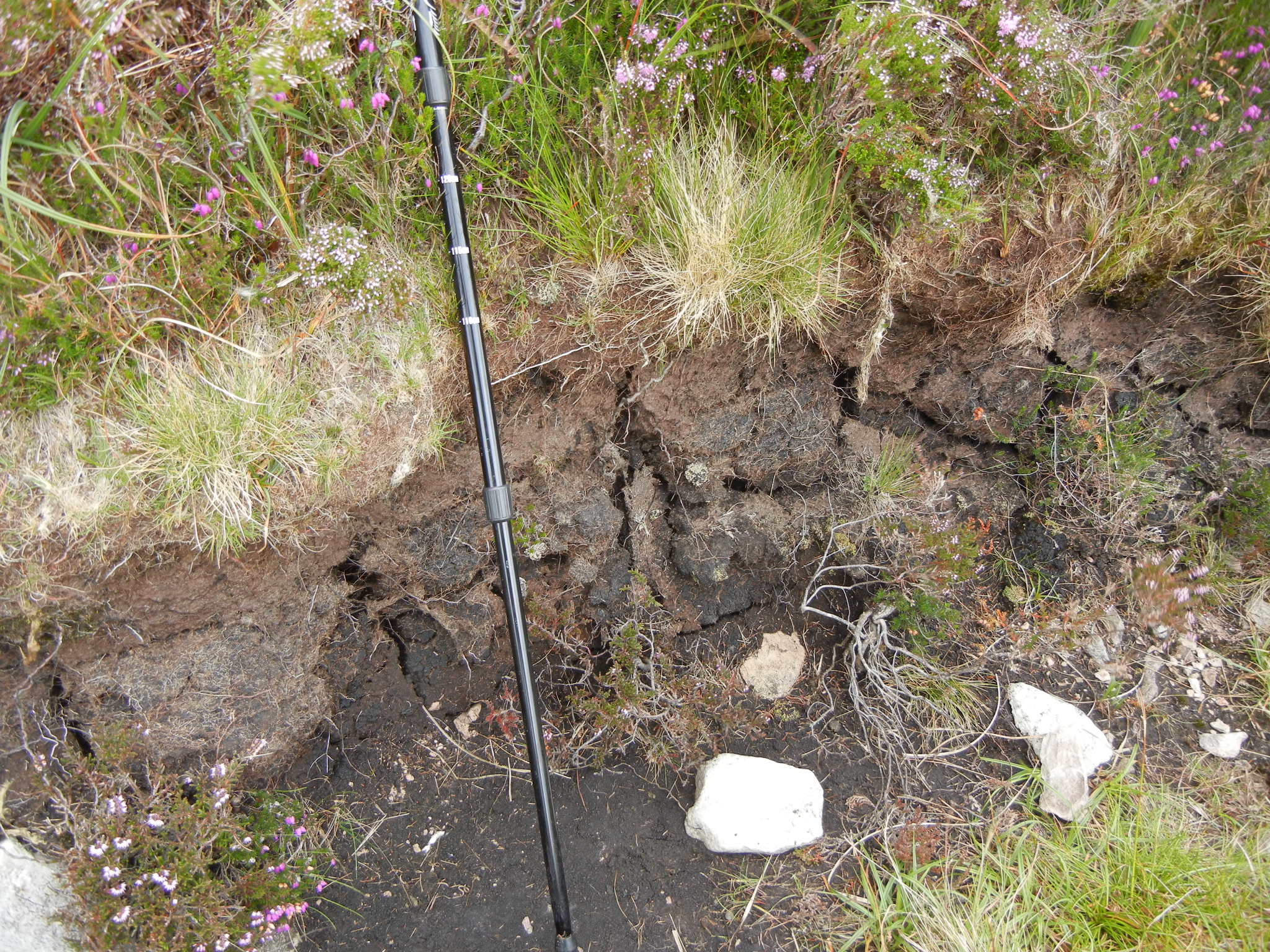
Peat near the top of the mountains that form the west side of Caragh Valley
Here’s a view looking north that shows the lower Caragh Lake as well as the small island and protrusion of land that pinches the lake into two parts:
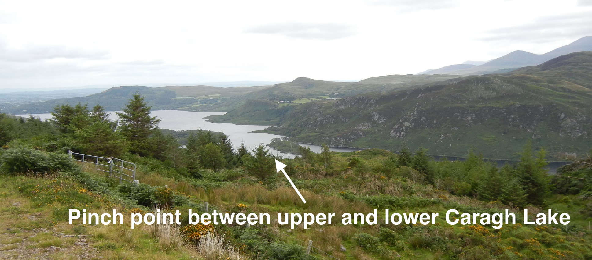
Lower Caragh Lake
As I hiked out of the valley, I could see the lower Caragh River (Hey, sorry about all the uppers and lowers when referring to the Caragh River and Caragh Lake!). A bit rocky. No wonder Larry and his crew had to drag the Seabird upriver along several stretches.
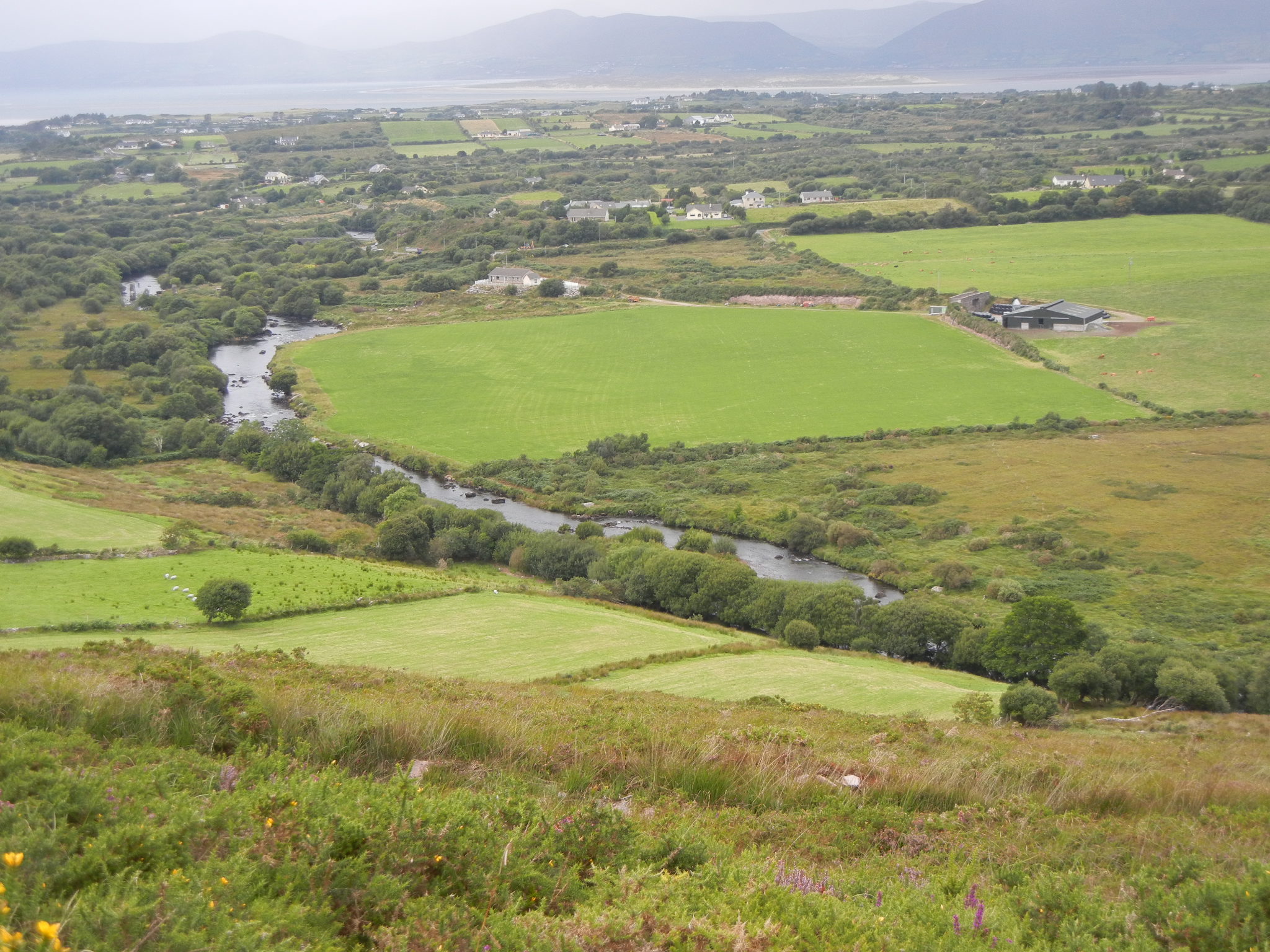
Lower Caragh River
Finally, after a long day, I reached the pickup point for the Taxi back to Dingle:
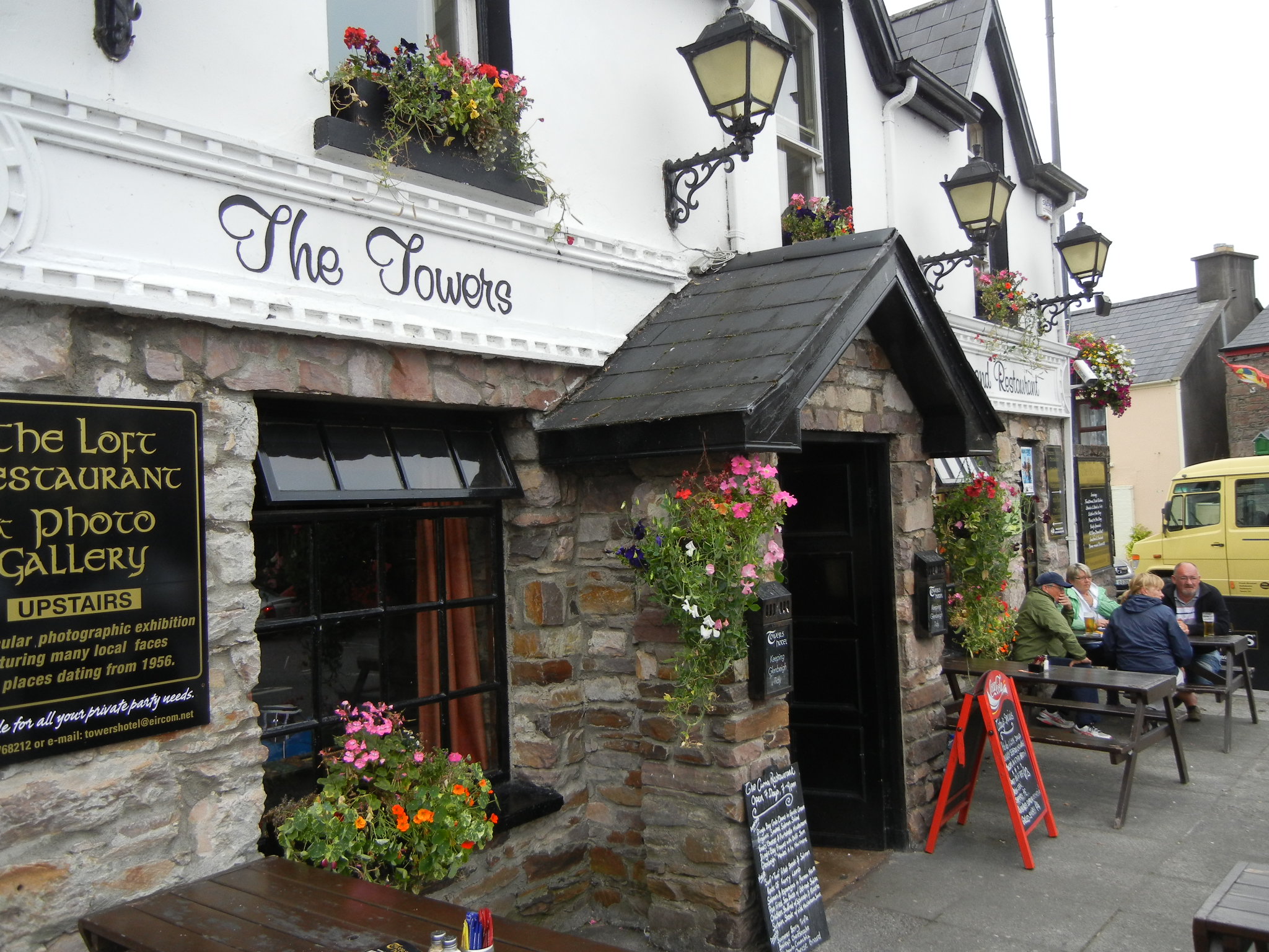
End of hike!
And, yes, Guinness is way better in Ireland…
best regards,
Walt
P.S. If you enjoy my books, please consider posting an honest review on the site from which you bought it. Reviews really help authors sell more books and readers discover new stories. Thank you!
PPS…and if you haven’t read one yet, remember that the eBook version of the first, Conflict, is free at Amazon, Kobo, and Nook.